Miller Peak - Teanaway
Spring is here so that means more mountain time! It has been strange snow year for Washington so low elevation non snow adventures have arrived early. So to kick off the year I headed out to Teanaway to bag Miller Peak and Iron Bear Peak.
Trip Logistics
Logistics here are fairly easy. Just drive to the trailhead, not too bad. The last few miles are on a Forest Service road with no reception though so holding onto a map to get you to the final destination is definitely worth it. The road eventually turns into gravel but you could definitely do it in a low clearance vehicle with no problems.
Trip Statistics
13.5 miles
4,000ft of elevation gain
Trip Report
The snow year up in the Pacific Northwest has definitely been strange so this allowed for some more early season adventures. I slept in and departed Seattle around 8:30 am. This got me to the trailhead to start around 10:30. There was only one other car parked at the Miler-Bear Trailhead and a set of backpackers who had just set off up Miller Peak Trail.
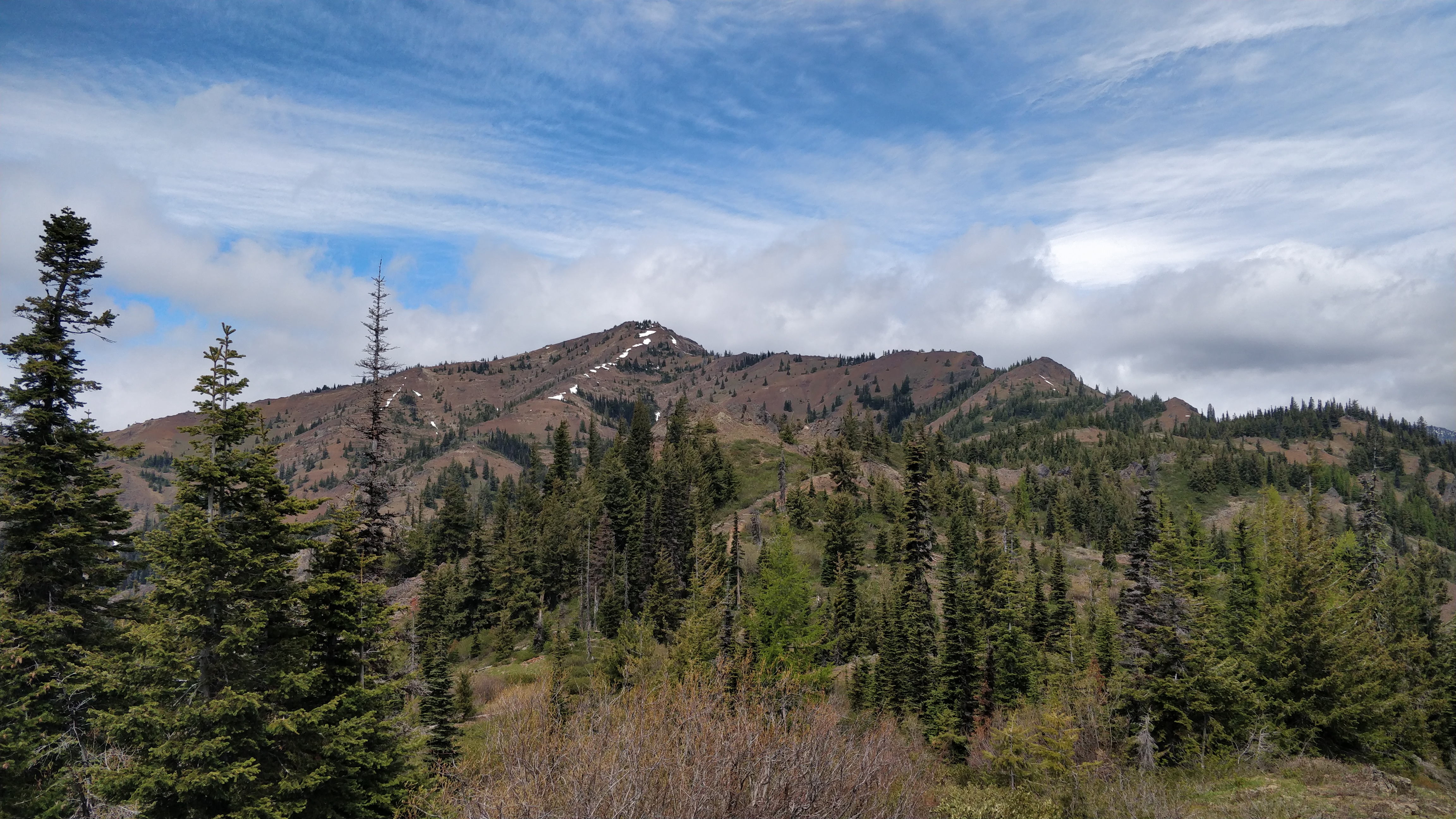
 |
| Miller Peak Trail ahead! |
I packed my bag and got to it, quickly passing the 3 backpackers and their beautiful dog. It was a long slow climb up towards Miller Peak. The sub alpine terrain felt very Sierra-esque with all the conifers lining the trail. The biggest difference was the denser underbrush up here.
 |
| The many trees lining the trail |
As I ascended, snow began to appear on the trail. The snow showed obvious signs of motor bikers who had traveled here before me. Thankfully they had brought saws and had cleared many of the blowdowns I would have otherwise had to climb over. That group must have turned around prior to Miller Peak as I began to encounter uncut blowdowns. I'm sure later in the season these would be eventually cut, but not for a few weeks at least.
The climb persisted, continuing up and up and up. The higher I got, the sparser the terrain. The trees began to be traded for shrubbery and flowers. The views of other mountains began to peak out as well as I make contact with the South West ridge of Miller Peak.
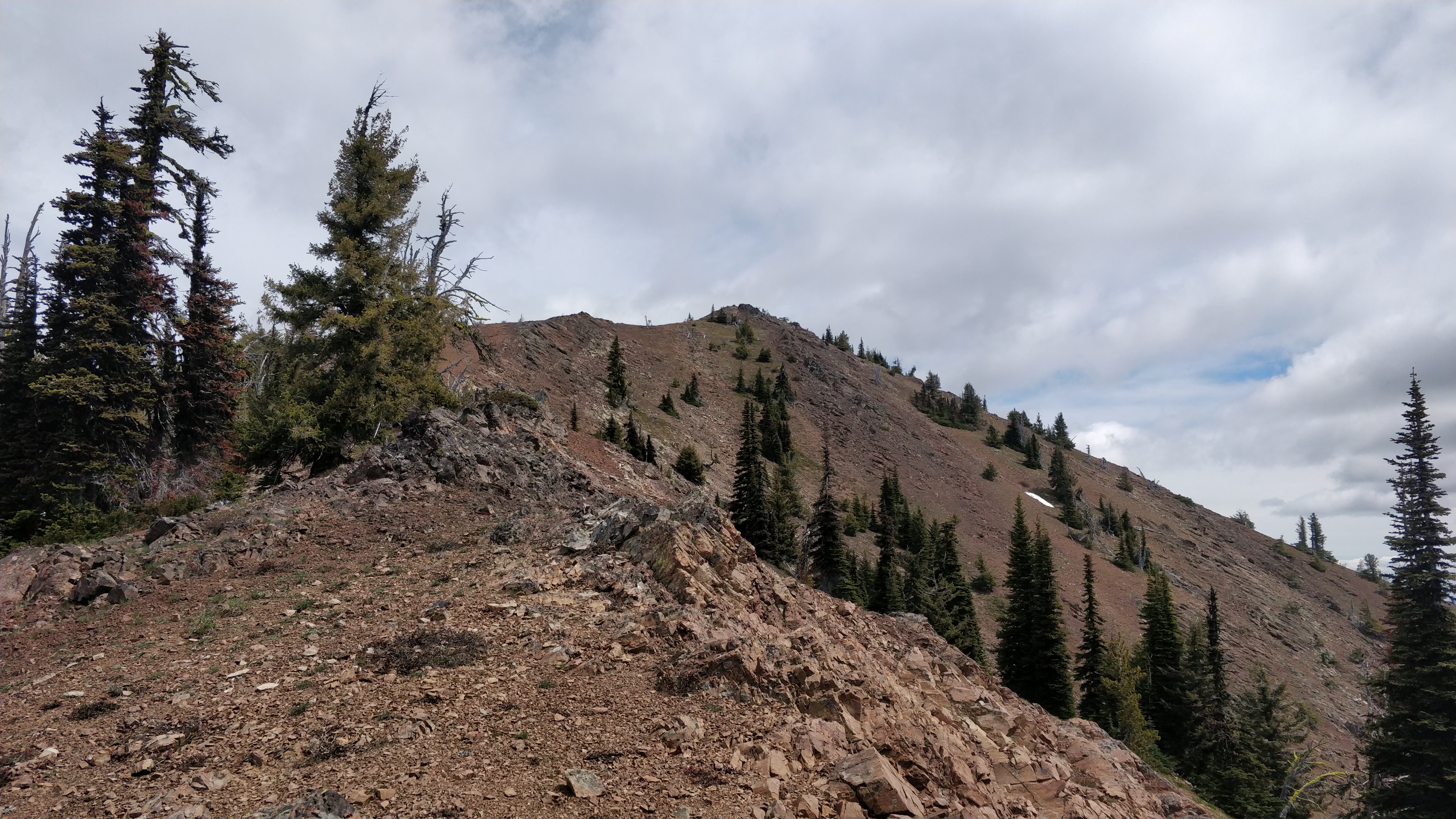
 |
| Looking East towards Iron Bear just as the trail meets the ridge. |
 |
| Looking North towards Three Brothers Peak |
As the trail works upward along the ridge, more snow began to appear. This started as small patches, but grew to steeper covered slopes. Some kicking steps, consultation with a GPS, and slow moving got me further upwards to the summit.
 |
| One of the more precarious slopes |
 |
| The summit in the distance |
Eventually I reached the summit of Miller Peak. The views were a bit cloudy but I still got a view of the top of the Enchantments and into Eastern Washington. I found the summit register but for some reason I could not open it. Maybe I have gotten weaker, or maybe I am just dumb and could not figure out the right way to get it open. Both are plausible and not mutually exclusive.
 |
| Could not get it open. Did not budge at all |
 |
| Still a smattering of snow! |
I wolfed down a snack and continued on by dropping off the east ridge of Miller Peak. I would not recommend it. The area is super sensitive with very soft soil. It definitely cannot take much wear unlike other surfaces. In retrospect I would have run back down the way I came and then headed east on County Line Trail.
 |
| Looking East from lower down on Miller Peak |
The descent was slow and careful due to the steep soft terrain. Eventually I intersected with County Line Trail which presented a much easier running surface. The trail heads toward Iron Bear Peak, a much more popular hiking destination. I begin to see more and more folks the closer I get, eventually reaching that final peak.
After reaching the summit, I descend the south side of the peak, eventually heading west on Iron Bear Trail. Once making that turnoff I did not see anyone else for the rest of the day. Seems like most folks come from the east.
Overall a solid first day out. The views were nice, the temperature was not too bad, and I had the trails mostly to myself.
Happy hiking!
-m


Comments
Post a Comment