Cone Peak via Carrizo Creek Trail
The Ventana Wilderness in Los Padres National Forest hosts a plethora of amazing trails for both backpacking and short day hikes. Located south of Monterey, the wilderness gives hikers access to the northern end of the Santa Lucia Range as well as the Pacific. While the northern portion of the Ventana Wilderness is very popular, venturing farther south will allow backpackers and hikers to skip the crowds and enjoy the trails alone.
Overview
Distance: 16 miles, out and back
Elevation gain: 5,000 feet
Getting to the Trailhead
Directions
Getting to the Carrizo Creek Trailhead is a little bit involved. First off, you must pass through Fort Hunter Liggett. When we drove through we were not stopped, but make sure everyone has photo ID and you have the proper paperwork in your car just in case. From there take Del Venturi Road through two river crossings. Continue onto Milpitas Road and eventually take a left onto Road 6. If you do not have a high clearance vehicle, you will have to park a little farther from the trailhead, adding about a quarter mile each way. Otherwise you will continue until you hit a small bridge with a closed gate. Park and continue over the bridge and the trailhead will be immediately on your right.
Trip Description
Our group of three started around 10 am at Carrizo Creek trailhead. From there we began our eight mile ascent up towards Cone Peak. Progress was slow as all three of us had not been backpacking in a while and were generally lacking fitness. Around mile three is where the fun began. The trail began to to close in on us and eventually we were bushwhacking our way through. Thankfully all three of us opted for long pants. While the brush was fairly dense, the direction of the trail remained clear and we continued on.
At 1:00 pm we took a much needed lunch and rest break. All of us were pretty tired and we were only 4.5 miles in.
We continued on and around forty five minutes later we finally were on the ridge line that contains Cone Peak. From there we got our first view of the Pacific.

We were excited to have made it up onto the ridge, until we realized we would have to descend to get to Cone Peak Trail. After descending for a little bit, we reached Trail Spring camp at 2:30pm. At this point we were all drained and in need of a break. We took the time to set up camp and purify some water. The stream was barely trickling, but we were able to get enough water out of it. After an hour and a half we packed up our dinner supplies and headed for the summit.
We finally made the summit at 5pm. After a full day of hiking we finally ran into some people, about six others on the summit. All three of us were exhausted and glad to drop our packs and prepare dinner. The other six left and the three of us got to enjoy a beautiful sunset over the Pacific.

By the time we finished it was pitch black. We made our descent back to camp with headlamps on. When we arrived, all of us crawled into the tent and passed out.
The next morning, we broke down camp and got hiking by 9am. We had to move fast if we wanted to dodge the rain. Thankfully we moved quick enough to only get sprinkled on a little bit. On our drive out, the drizzle turned into a pour and we were very glad to have gotten out quickly. The trip was two days well spent, I would definitely recommend this trip if you are short on time and want some nice views.
Handy Planning Information
Summit Post
Ventana Wilderness Alliance
Interactive Los Padres Map
1/2/2018
 |
| View of the Cone Peak from Carrizo Creek Trail |
Overview
Distance: 16 miles, out and back
Elevation gain: 5,000 feet
Getting to the Trailhead
Directions
Getting to the Carrizo Creek Trailhead is a little bit involved. First off, you must pass through Fort Hunter Liggett. When we drove through we were not stopped, but make sure everyone has photo ID and you have the proper paperwork in your car just in case. From there take Del Venturi Road through two river crossings. Continue onto Milpitas Road and eventually take a left onto Road 6. If you do not have a high clearance vehicle, you will have to park a little farther from the trailhead, adding about a quarter mile each way. Otherwise you will continue until you hit a small bridge with a closed gate. Park and continue over the bridge and the trailhead will be immediately on your right.
Trip Description
Our group of three started around 10 am at Carrizo Creek trailhead. From there we began our eight mile ascent up towards Cone Peak. Progress was slow as all three of us had not been backpacking in a while and were generally lacking fitness. Around mile three is where the fun began. The trail began to to close in on us and eventually we were bushwhacking our way through. Thankfully all three of us opted for long pants. While the brush was fairly dense, the direction of the trail remained clear and we continued on.
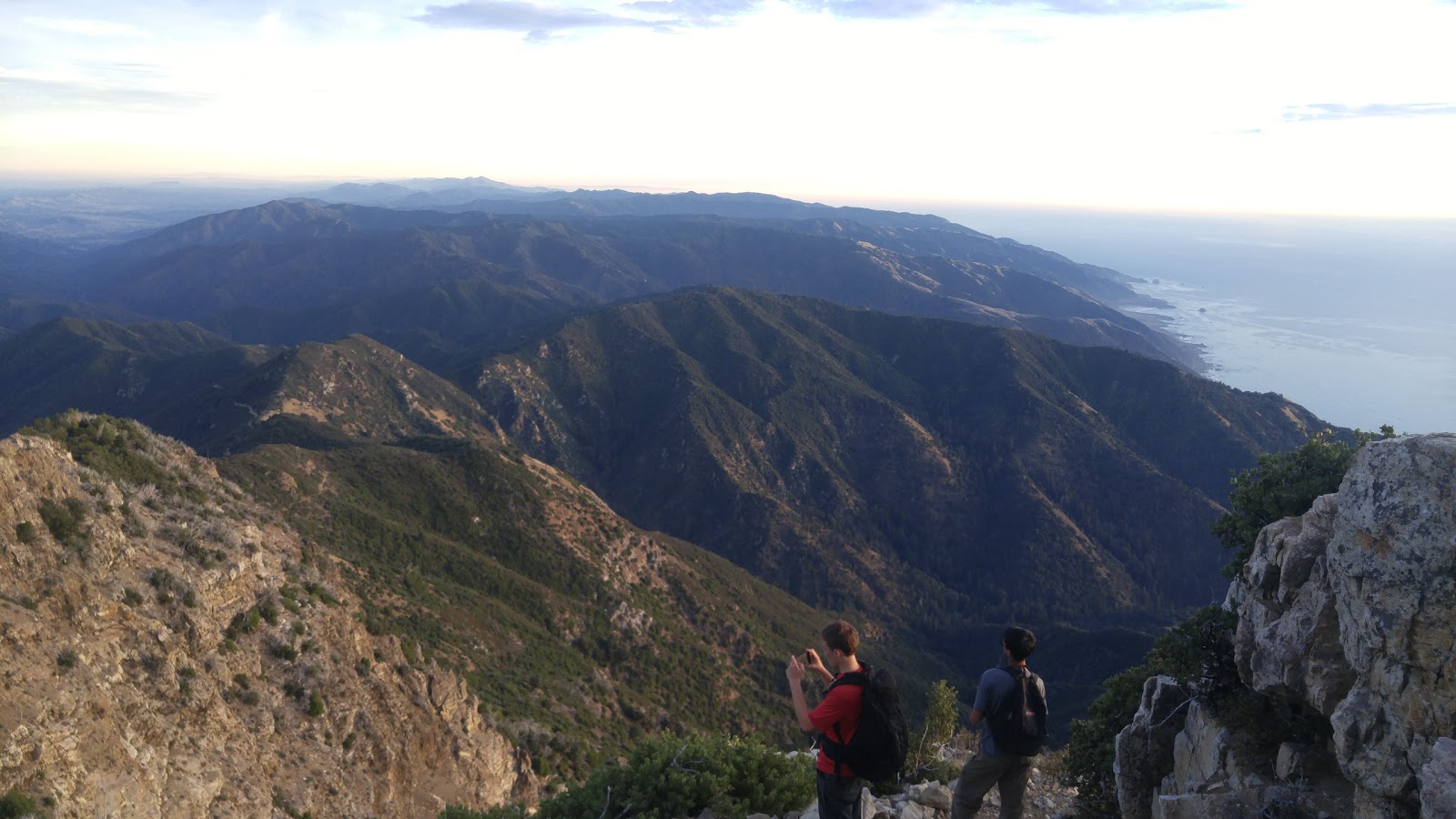
At 1:00 pm we took a much needed lunch and rest break. All of us were pretty tired and we were only 4.5 miles in.
 |
| The view south from our lunch spot |
We continued on and around forty five minutes later we finally were on the ridge line that contains Cone Peak. From there we got our first view of the Pacific.

We were excited to have made it up onto the ridge, until we realized we would have to descend to get to Cone Peak Trail. After descending for a little bit, we reached Trail Spring camp at 2:30pm. At this point we were all drained and in need of a break. We took the time to set up camp and purify some water. The stream was barely trickling, but we were able to get enough water out of it. After an hour and a half we packed up our dinner supplies and headed for the summit.
 | ||
| View of the summit, almost there |
 | |
| View south, right below the summit |

By the time we finished it was pitch black. We made our descent back to camp with headlamps on. When we arrived, all of us crawled into the tent and passed out.
The next morning, we broke down camp and got hiking by 9am. We had to move fast if we wanted to dodge the rain. Thankfully we moved quick enough to only get sprinkled on a little bit. On our drive out, the drizzle turned into a pour and we were very glad to have gotten out quickly. The trip was two days well spent, I would definitely recommend this trip if you are short on time and want some nice views.
Handy Planning Information
Summit Post
Ventana Wilderness Alliance
Interactive Los Padres Map
1/2/2018

Comments
Post a Comment