Ostrander Lake Loop - Yosemite National Park
 |
| Buena Vista Lake |
Trip Logistics
This trip starts at Ostrander Lake Trailhead on the southern side of Glacier Point road. It travels up to Ostrander Lake, hits Buena Vista Lake, and then loops back to the trailhead. There is a little cross country hiking that must be done beyond Ostrander Lake but it is fairly simple navigation and is no more than first class terrain. Other than that you will be on trail the whole time, there are a quite a few streams so maybe be prepared for that if you decide to go early summer.
Permitting is done through Yosemite National Park. This is my first time applying for a wilderness permit for Yosemite so I cannot describe how it normally goes as we applied with a different process due to COVID-19. Bear canisters are always required in Yosemite, hanging food is not allowed. They can be rented for $5 a week from the park.
Trip Statistics
3 days
22.2 miles
3700 ft of elevation gain
Daily Mileage
Day 1: 6.6 miles with 2,000 feet of gain
Day 2: 9.6 miles with 1,500 feet of gain
Day 3: 6 miles with 500 feet of gain
Map
Conditions and Closures
Permits
Trip Report
As my final summer after college came to an end, a final backpacking trip was in order. As someone from northern California, there was only one appropriate final destination, Yosemite! After a bit of research the route was outlined and the permits were applied for. Thankfully we got our first choice, the Ostrander Lake trailhead where we originally had planned for a four day trip. Per usual, the itinerary changed on route, thankfully not by much this time.
The trip already was off to a good start with a trip to a couple days before departure. After summer of backpacking my friend Lauren was hooked enough on backpacking to want to give up on my uncomfortable climbing packs and bring her own. After about forty five minutes with a very patient and lovely gal at the REI in Saratoga she was outfitted with a new pack and ready for the trail!
We departed the bay yet again on Tuesday night, arriving just outside the park at around 1 am. There was quite a lot of roadwork going on so progress once we hit Stanislaus National Forest was slow. After a night in the back of the car we were up and driving again by 7 am to avoid the traffic.
Day 1
We arrived at the trail head around 9:15 am and on trail by 10:00 am. There were a few cars there already there but we were the only humans in sight. There were five or six bear boxes for food and the nicest pit toilet I've had the pleasure of sitting on.
 |
| Ostrander Lake Trailhead |
 |
| Heading to Ostrander Lake |
The first half of our day was relatively flat. Not very much elevation gain, dusty trails, and beautiful meadows. There was a bit of shade, but not enough to make it super enjoyable. Both Lauren and I were glad to be wearing long sleeves and hats for that good sun protection. We passed two separate trail intersections, turning left both times.


After the second intersection is where the climbing began. We would ultimately cover around 2,000 feet of elevation gain this day, and that is where it truly begins. The burned through meadows and forests offered little respite from the glaring sun.
 |
| Continuing up |

After grinding out the next two and a half (ish) of climbing, we made it to Ostrander Lake and the ski hut there. We had passed about six people heading down and saw one person at camp at the lake. Skirting around the north east side of the lake we found a good spot, dropped our packs, dipped our feet in the water, and enjoyed the views and lunch.
 |
| A bit of the lake and the hut |

 |
| The view from our beautiful lunch spot. |
We hung around for lunch for about an hour and a half. We munched on hummus and bread while taking in the views. After thoroughly enjoying ourselves we decided rather than camp near this lake that we could begin our cross country journey east towards Hart Lakes and try and cut down our day two mileage. We began heading upwards towards the next mini lake. The path of least resistance was our plan, heading east. If it was too steep we were probably going the wrong way.
 |
| Our lovely campsite |
Day 2
We were awake at some time the next day (who knows, I don't). Lauren took a quick meditation session while I began breaking down camp. After sufficiently breaking down camp, we paused for breakfast. I took a few handfuls of trail mix while Lauren opted for oatmeal. Rather than boil some water she just added some cold water and went for it. It was absolutely revolting but she found a way to finish it in the name of energy.
We were on trail and moving by 9:30 am. We followed the same technique, heading directly east following the path of least resistance. Eventually the area to our left opened up to some beautiful views of Half Dome, Mt. Clark, and the rest of Yosemite. From there we started to veer a little bit more south but we maintained a mostly eastward direction. Before we knew it we were heading down towards Hart Lakes.
 |
| The kind of terrain we are on. This is where the northern side opens up to some views. |
 |
| The view north |

We followed the occasional cairn, following the easiest path down. It is fairly easy with occasional class two sections (very brief).
After the fairly quick descent we arrived at Hart Lakes. The bottom of the lake looked a bit muddy so we decided not to get in for a swim. We headed around the northern end of the lake, taking a quick break to filter water once we hit the creek on the eastern end of the lake. The creek was not flowing, but I could imagine it will earlier in the season with all the snow melt.
 |
| Hart Lakes |
 |
| A not super steep part of our descent |
Once we hit the trail we headed southbound, this would be the only climb of the day. There was a decent amount of tree cover, a definitely welcome addition. We crossed Buena Vista Creek twice, both times completely dry.
Eventually we reached the steeper section of the climb which conveniently lost all tree cover. We slowly moved our way up to the top where we were rewarded with a great view of the Clark Range.
 |
| The Clark Range hanging out in the background |
 |
| Onward toward Buena Vista Lake |
After reaching the top, the trail flattened out for a bit. We hit the next trail intersection and took a left to visit Buena Vista Lake. It was about a quarter of a mile until we hit the lake. We settled on the northern end of the lake, looking out upon the beautiful blue water and the rocky crest.
 |
| Buena Vista Lake |
 |
| Another view of Buena Vista Lake |
We sat down and and hung out for a couple of hours. We ate lunch while dangling our feet in the clear water. After a bit we decided to get in. I waded about mid thigh deep and quickly retreated because it was cold and I am a big fan of being a comfortable temperature. Lauren on the other hand went full send and jumped completely in. Eventually we dried off, hung out in the sun for a bit longer, and dawned our packs and moved along.
We backtracked towards the previous trail intersection where we would take a left. At the intersection we ran into a group of four other backpackers. They had also come up Buena Vista Creek and were slightly worried because of how dry the creek was. We assured them that they were close to the lake where they could have all the water they wanted and we offered them some in the meantime, of which they declined. We continued onward, descending towards Chilnualna Creek.
 |
| Descending |
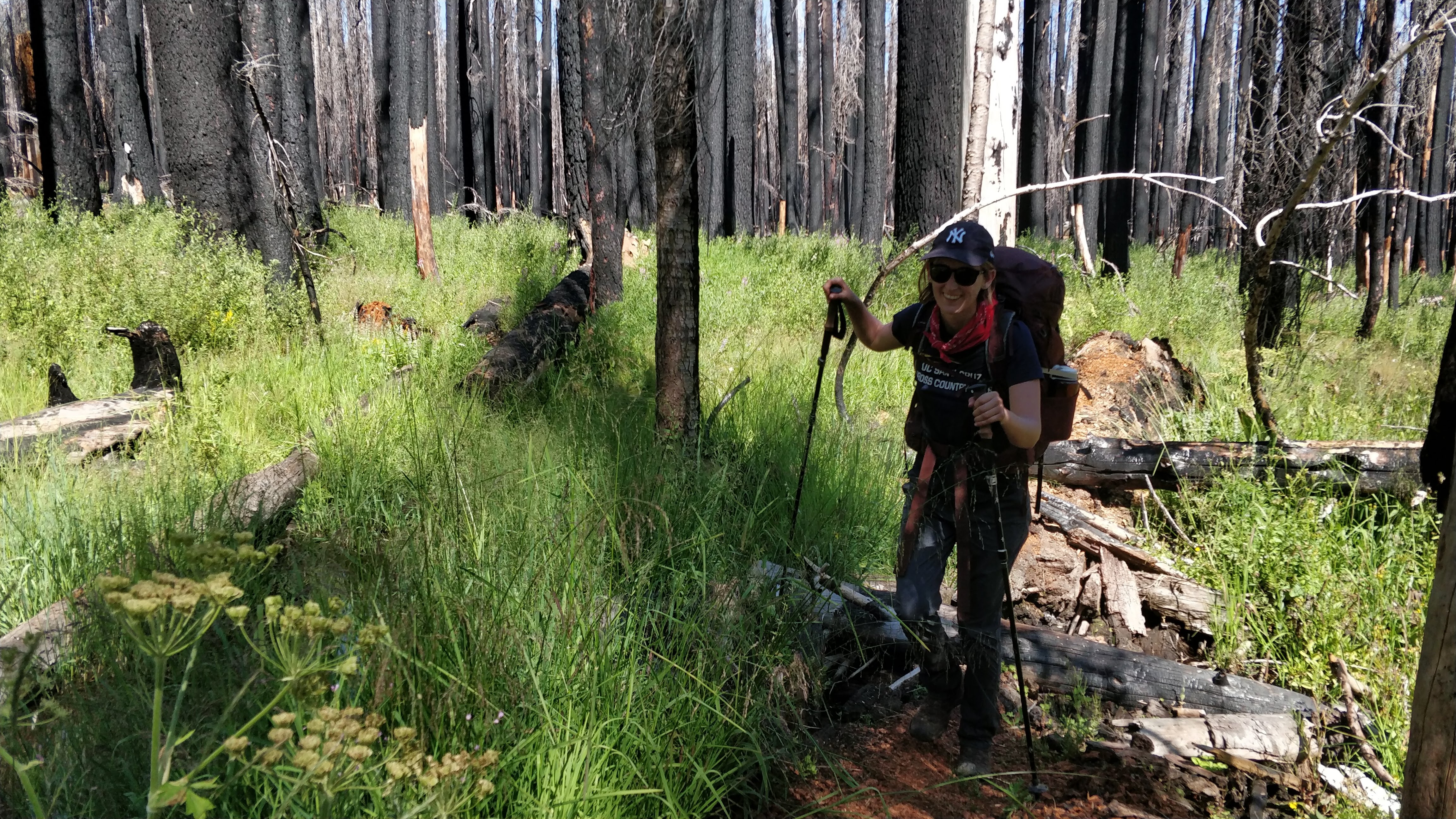
We made good progress on the final downhill of the day. We went through burned out wooded areas, swampy grasslands, and beautiful meadows. Chilnualna Creek was fairly stagnant which was slightly disconcerting. The trail report said it was 6 + inches and flowing yet we saw little to know water, let alone flow. At the next intersection, we opted to turn right and head northwest, in the direction of the car.
 |
| Making away through the meadows |
 |
| Still smiling after a while on trail |

Originally we planned to camp at the intersection and day hike to Chilnualna Falls the next day. Because of the creek being dry we were worried we would be caught without water the next night. We opted to head towards the car, giving us the best chance of not having a terrible third day. After heading northwest for about a mile and some change, we found a nice campground to the right of the trail. We quickly pitched camp, ate dinner, and got in the tent before the mosquitoes ate us alive.
 |
| Our campsite the next morning. |
Before heading to sleep we discussed our options for the next day. The two key issues we saw with the next day would be lack of water and food. The creeks appear to be pretty dry so we doubted whether we would run into very much running water the next day. That meant that our only option for a for sure water source would be Ostrander Lake, roughly eight miles away. Also because we only brought a single bear canister, we were a bit tight on food. We could make it another day, but we would definitely be pressed for food on the final day. With all that in mind, we opted to hike out the next day than push our limits.
Day 3
After another nights sleep we were ready to take on our third and final day. I opted for a few handfuls of trail mix in the morning while Lauren ate her cold water oatmeal. This would be our easiest day with only 500 feet of climbing over the course of six or so miles. It was definitely one of the warmer days, and the lack of tree cover definitely continued to remind us. Even though we saw tons of trees, almost all of them were burned through from previous fires.
 |
| Meadows! |

 |
| Lauren is better at finding the easiest ways to cross creeks than me |

We eventually got back to the trail head. It was a Friday so we had seen quite a few parties on their way in, definitely glad to be able to hike during the week. Once we got back to the car we were greeted by a surprisingly cool car and even a bit of cold water. We packed up our stuff and started our drive home.
Very very fun trip, once you get past Ostrander Lake it does feel like you are quite far away from anything else. I could imagine this trip being much wetter if you go early in the season. In early August we seemed to have missed the snow and mosquitoes but were a bit strapped for water. Earlier on I could see the meadows we went through being quite muddy, so gaiters and boots may be nice.
Overall, a great three day trip. If you are looking to find the less crowded side of Yosemite but still enjoy the beautiful terrain, I think this is a great trip for you. Also if you want to give your hand at low risk cross country travel, definitely a good choice.
Happy hiking!
-m


Absolutely BEAUTIFUL! A great way to end the summer :)
ReplyDelete